
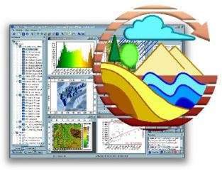
Geotools typically refer to software libraries or toolkits designed to facilitate geospatial data processing, analysis, and visualization. These tools are used by developers, GIS (Geographic Information System) professionals, researchers, and others who work with spatial data.
Geotools often include functionalities such as:
- Reading and writing various geospatial file formats (e.g., shapefiles, GeoTIFF, KML).
- Geometric operations like buffering, intersection, and union.
- Projections and coordinate transformations.
- Spatial analysis such as overlay operations, distance calculations, and spatial statistics.
- Cartographic rendering and visualization.
These tools are crucial for a wide range of applications including urban planning, environmental monitoring, natural resource management, disaster response, and more. Geotools enable users to effectively manage and analyze spatial data, making informed decisions based on geographic information.

ArcGIS, QGIS, and GrassGIS
- To DOWNLOAD Click the Free Download button it will take you to the Windows store where you can download the program.
- If you encounter any issues with your download, please report them here.
SYSTEM FOR AUTOMATED GEOSCIENTIFIC ANALYSIS (SAGA) GIS
- To DOWNLOAD Click the Free Download button it will take you to the Windows store where you can download the program.
- If you encounter any issues with your download, please report them here.

VULCAN
- To DOWNLOAD Click the Free Download button it will take you to the Windows store where you can download the program.
- If you encounter any issues with your download, please report them here.

SEISAN
- To DOWNLOAD Click the Free Download button it will take you to the Windows store where you can download the program.
- If you encounter any issues with your download, please report them here.

AQTESOLV
- To DOWNLOAD Click the Free Download button it will take you to the Windows store where you can download the program.
- If you encounter any issues with your download, please report them here.

DATAMINE
- To DOWNLOAD Click the Free Download button it will take you to the Windows store where you can download the program.
- If you encounter any issues with your download, please report them here.

Fabric 8
- To DOWNLOAD Click the Free Download button it will take you to the Windows store where you can download the program.
- If you encounter any issues with your download, please report them here.

GeoVES
- To DOWNLOAD Click the Free Download button it will take you to the Windows store where you can download the program.
- If you encounter any issues with your download, please report them here.

Rockworks 16
- To DOWNLOAD Click the Free Download button it will take you to the Windows store where you can download the program.
- If you encounter any issues with your download, please report them here.

TERRAMETER, GEOTRON, and PQWT Series
- Terrameter SAS 300/1000
- PQWT 150/300/500 Series
- GEOTRON
- SEISMOELECTRICS

WaterCAD, WaterGEM, Epanet
- To DOWNLOAD Click the Free Download button it will take you to the Windows store where you can download the program.
- If you encounter any issues with your download, please report them here.

